
Below are maps that show Missouri 911 service levels, funding, text-to-911 capability, and interconnections by county. To request updates or requests to these maps, please contact the Board at admin@missouri911.org.

Missouri 911 County Service Level Phase Map
Updated June 12, 2025.
Download a PDF of this map here.
Click here to view this map overlaid with Congressional District Boundaries.
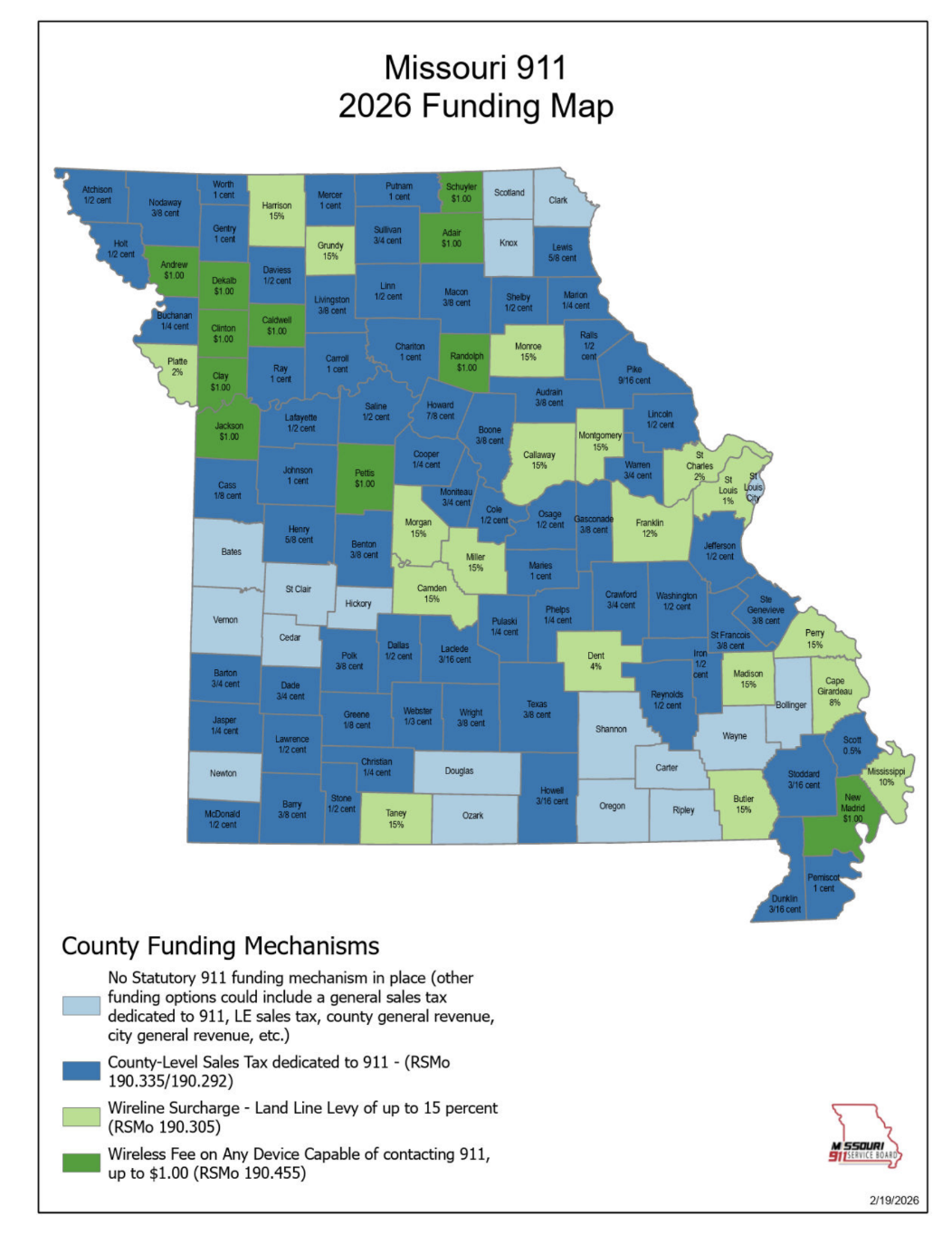
Missouri 911 Funding Map
Updated February 20, 2026.
Download a PDF of this map here.
Click here to view this map overlaid with Congressional District Boundaries

Missouri 911 Text-to-911 Map
Updated June 25, 2025.
Download a PDF of this map here.
Click here to view this map overlaid with Congressional District Boundaries.

Missouri 911 Interconnections
Updated January 16, 2025
Download a PDF of this map here.

Missouri 911
Service Board
GIS Data Remediation Grants
Updated January 24, 2025.
Download a PDF of this map here.

Missouri 911 Service Board Grant Program
Updated April 1, 2025
Download a PDF of this map here.

Emergency Medical Dispatch
Updated June 12, 2025.
Download a PDF of this map here.
Click here to view this map overlaid with Congressional District Boundaries

MO 911 Service Board NG911 ARPA Grants
Updated January 22, 2025
Download a PDF of this map here.